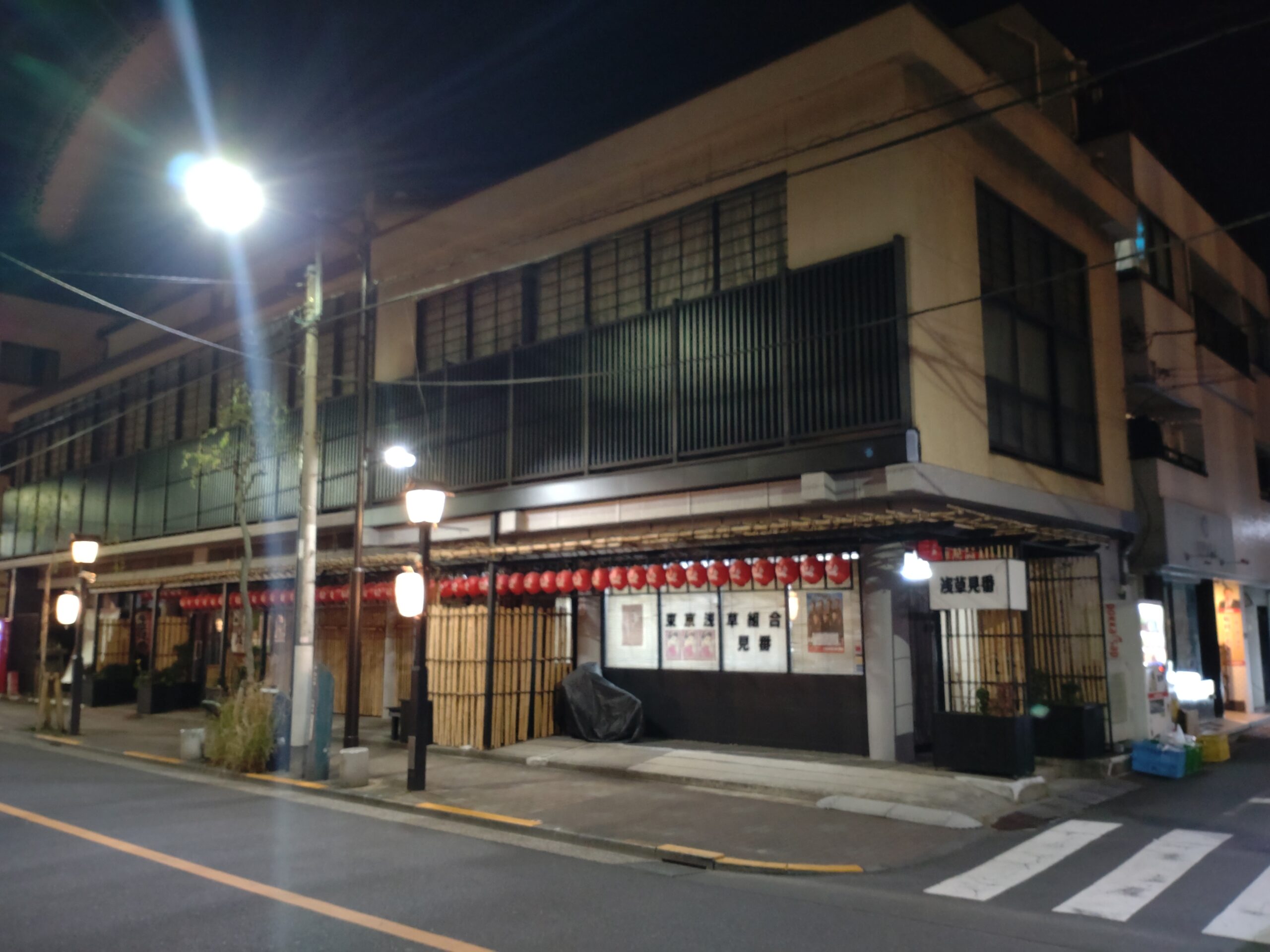
Ōta Dōkan, the founder of Edo Castle
Ashikaga Shigeuji, the Kamakura Kubo of the Muromachi shogunate, fled Kamakura and relocated to Koga, controlling the eastern half of the Kanto region across the Tone River; thereafter, he and his successors came to be known as the Koga Kubo. Meanwhile, the western half was controlled by the Uesugi clan, who held the post of Kanto Kanrei, resulting in a prolonged conflict between the two factions across the Tone River (present-day Sumida River). This war-torn period of the Muromachi era in Kanto serves as the historical backdrop for Takizawa Bakin‘s Nanso Satomi Hakkenden. Castles such as Edo, Akatsuka, and Kawagoe were frontline strongholds built by the Ōta clan, who served the Uesugi, and were interconnected by what is today known as the Kawagoe Kaido.
It was Ōta Dōkan who built the first castle in Edo. He achieved a series of victories across the entire Kanto region, but was eventually assassinated by the Uesugi clan, who feared his growing power and influence. Nevertheless, the Uesugi clan itself was subsequently driven out of Kanto by the Later Hojo clan, who rose to power from Izu.
Hojo Ujiyasu was the third-generation head of the Later Hojo clan (a grandson of Hōjō Sōun). He was the very man who defeated the Uesugi clan at the Siege of Kawagoe Castle (川越夜戦; Kawagoe Night Battle) and emerged as the ruler of the Kanto region. Ujiyasu may have been the first person to produce a detailed map of Edo, which I find very impressive.
The era when Hōjō Ujiyasu ruled Edo circa 1560.
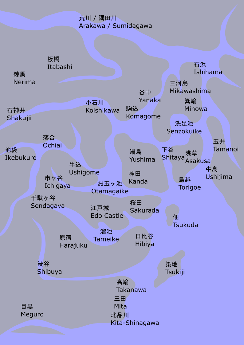
The terrain may be inaccurate, but the topology of the islands is considered reliable. The most notable point may be that a distributary of the Sumida River flowed between Yanaka and Shitaya, emptying into Otama-ga-ike Pond, and Asakusa was located on an island with Torigoe and Shitaya (References written in Japanese: 古地図から読み解く江戸湊の発展 その1 / その2. see also the elevation map by Geospatial Information Authority of Japan). Furthermore, the fact that Mikawashima, Minowa, and Ishihama were located on the exact same sandbar implies that this sandbar was sandwiched between the Sumida River and its tributary, and was not contiguous with Asakusa.
The place name “Asakusa” and the earliest record of Sensoji Temple first appear in the Azuma Kagami, revealing that Sensoji already existed by the early Kamakura period. In the Kanto region, which was then a wilderness compared to Nara and Kyoto, the temple boasts an exceptionally long history. It is truly astonishing that its origins may coincide with, or even predate, the founding of Tsurugaoka Hachimangu Shrine by Minamoto no Yoriyoshi—though older shrines like Kashima Jingu and Katori Jingu, which date back to the Kofun period, certainly exist in the region. Asakusa has endured as a single town for over a millennium. Even as buildings are rebuilt, shop owners change, and the Main Hall of Sensoji was reconstructed in reinforced concrete with titanium roof tiles following war damage, the momentum accumulated over a thousand years wraps this town in an irresistibly nostalgic atmosphere.
My hypothetical map of Edo around 1560.
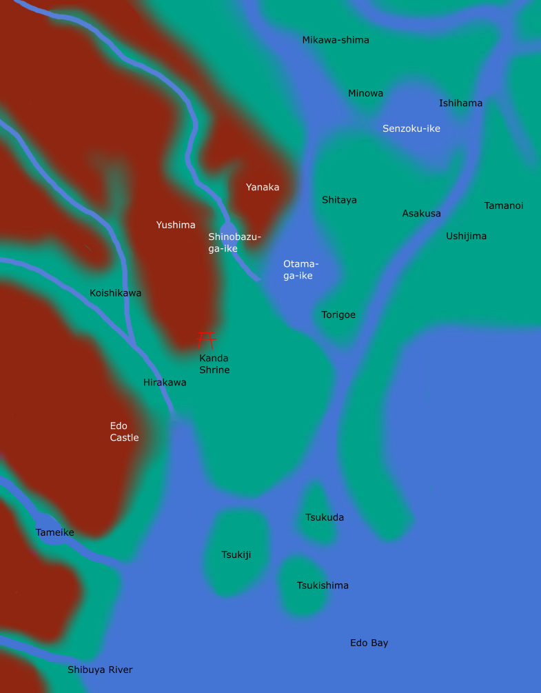
Topographically, Shinobazu Pond was likely a reservoir created by damming the former Shakujii River. The vast wetland beyond it was gradually reclaimed, leaving only Otama-ga-ike Pond by the Edo period, which was also eventually filled in during the mid-Edo period. It is thought to have been located around present-day Akihabara. Senzoku-ike must have been the lowland area around present-day San’ya.
Presumably, an ancient branch of the Tone River once flowed between Yanaka and Shitaya. However, as its main current shifted further east, this area rapidly silted up, dried out, and turned into dry land, suggesting that Mikawashima also became continuously connected to the Musashino Plateau.
Asakusa Temple in 1879 (12th year of Meiji era)
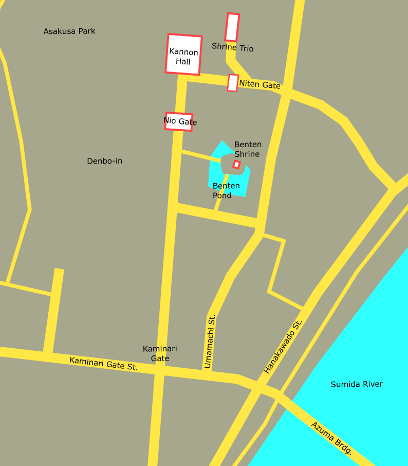
At that time, neither Kaminarimon Gate nor Denboin Temple had been reconstructed yet. It is highly unnatural that the approach to Asakusa Shrine turns outward at Nitenmon Gate. This may be due to the influence of the Shinto-Buddhism Separation Orders issued by the Meiji government. The grounds of Sensoji Temple were developed by the Meiji government as an urban park, which came to be known as Asakusa Park.